
Professional Land Surveying & Drone LiDAR Mapping
Experienced Land Surveyors
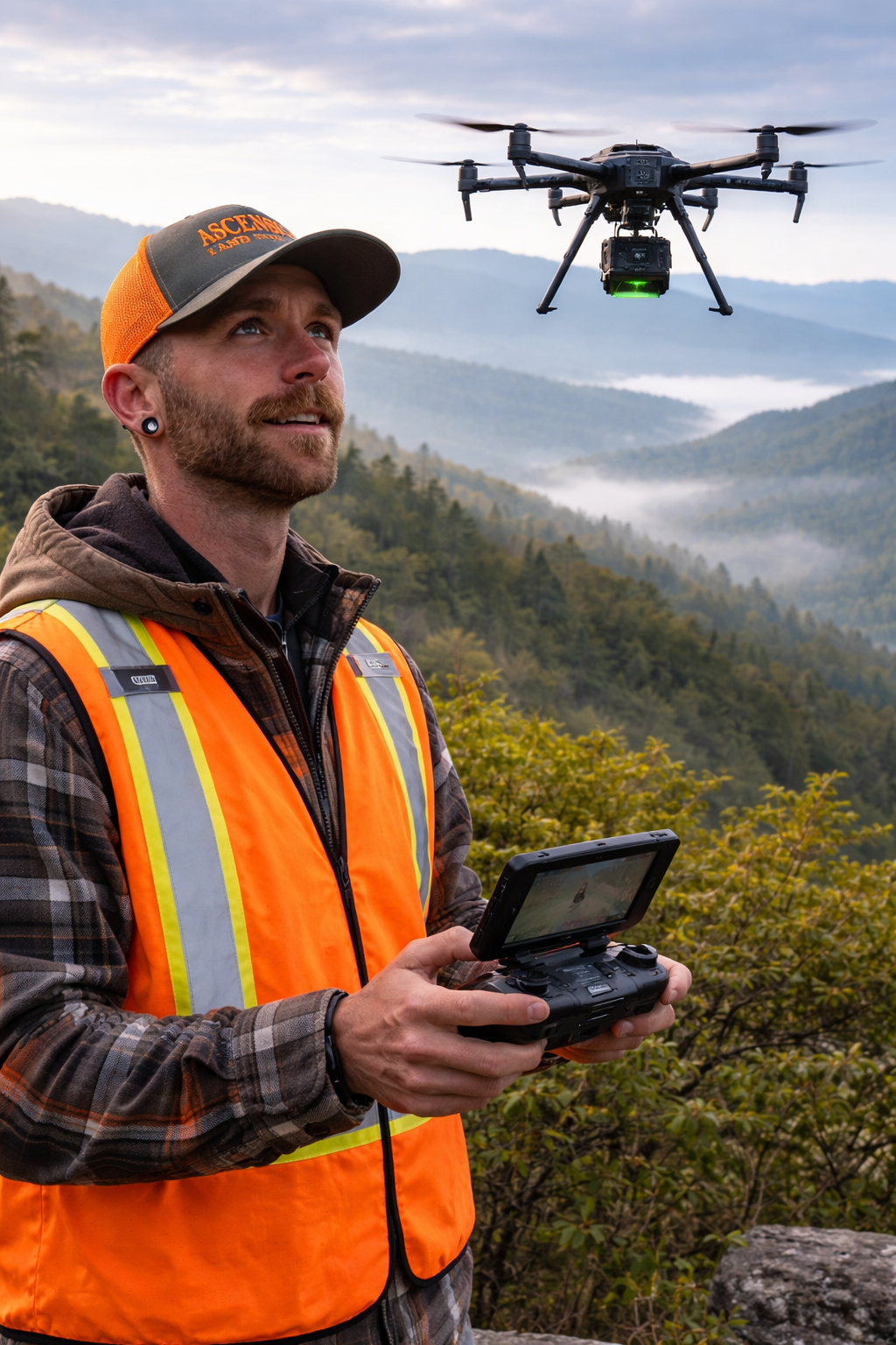
FAA Licensed Drone Operations
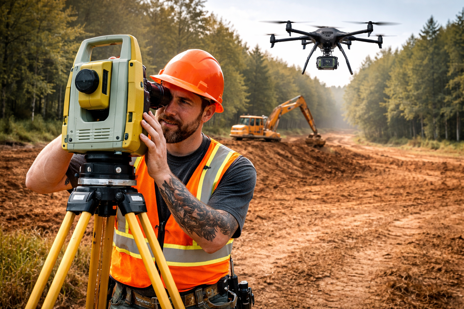
Advanced Drone LiDAR Mapping Technology
Serving North Carolina & Tennessee
Providing professional surveying, aerial LiDAR mapping, and high-accuracy terrain data for residential, engineering, construction, and development projects across North Carolina and Tennessee.
Ascension Land Surveying provides professional land surveying, drone LiDAR surveying, aerial mapping, and terrain modeling services for engineering firms, developers, and construction projects across North Carolina and Tennessee.

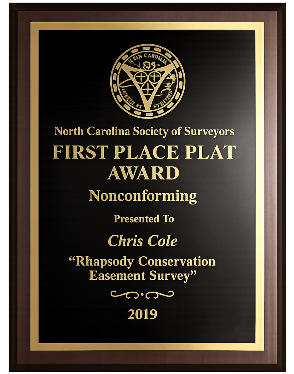
Certifications, Qualifications & Awards
Professional Credentials You Can Trust
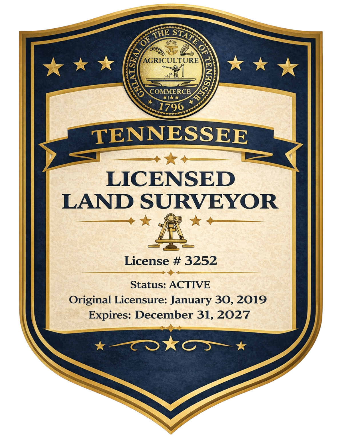
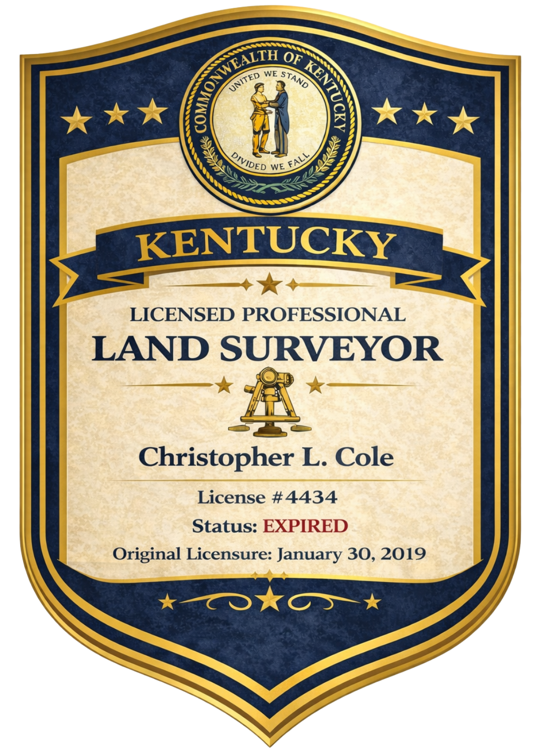
Ascension Surveying maintains the professional certifications and qualifications required to provide reliable land surveying and drone-based LiDAR mapping services for engineering, construction, and development projects. Our team is committed to maintaining the training, licensing, and operational standards necessary to deliver accurate data and dependable results.
Our certifications and qualifications include:
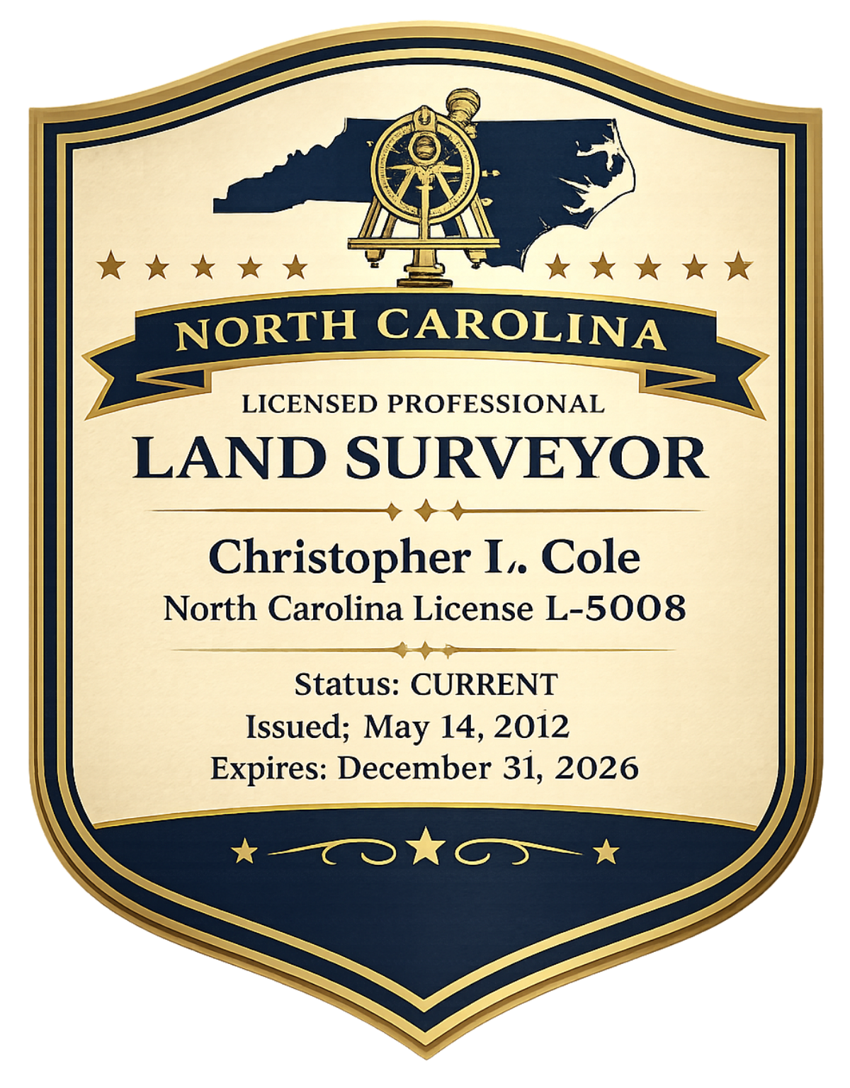
Licensed Professional Land Surveyor
FAA Part 107 Certified Drone Pilot
Advanced Drone LiDAR Mapping Technology
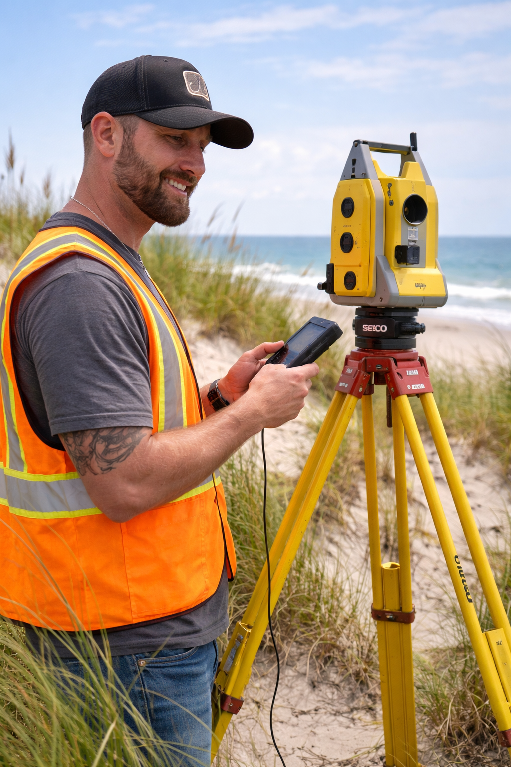
Professional Surveying Equipment & GNSS Systems
These certifications ensure that our surveying operations meet the professional standards required for engineering projects, infrastructure development, and aerial mapping operations throughout North Carolina and Tennessee.


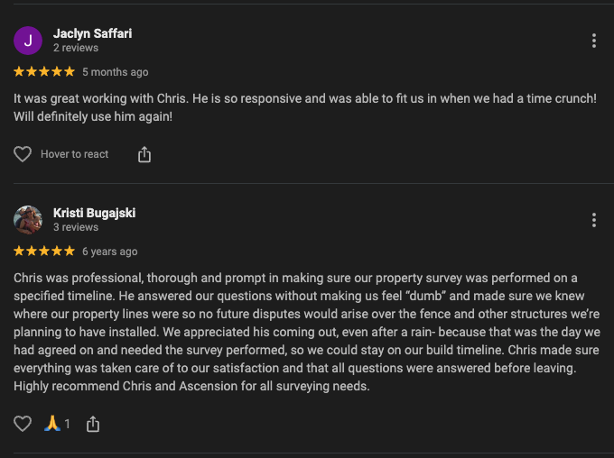
Client Reviews
Trusted by Property Owners, Engineers, and Developers
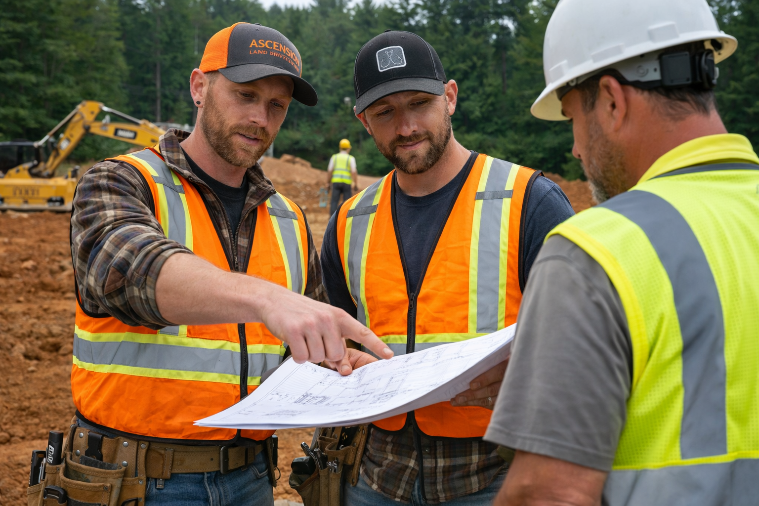
At Ascension Surveying, our work speaks through the success of the projects we support and the relationships we build with our clients. From landowners and developers to civil engineers and construction teams, our clients rely on us for precise data, clear communication, and dependable results. Read what our clients have to say about their experience working with Ascension Surveying and how our surveying and drone mapping services help move their projects forward with confidence.


Our Services
Ascension Surveying provides a full range of professional land surveying and aerial mapping services designed to support engineering, construction, and land development projects across North Carolina and Tennessee. Our team combines years of field experience with modern surveying technology, including drone-based LiDAR systems and aerial mapping platforms, to deliver accurate data and dependable results.
From traditional boundary surveys to advanced terrain mapping and construction site analysis, our services help engineers, developers, and contractors obtain the precise geospatial information needed to plan and execute successful projects. By utilizing both ground-based surveying methods and modern aerial mapping technology, we are able to efficiently collect high-quality data across large areas, complex terrain, and active job sites.
Our surveying services are commonly used for site planning, infrastructure development, construction layout, and large-scale terrain modeling. Whether a project requires detailed property boundary work or high-resolution aerial LiDAR mapping, Ascension Surveying is committed to providing accurate measurements, professional service, and reliable communication throughout every stage of the project.
Explore our services to learn how Ascension Surveying can support your next project.

Our Story
Ascension Surveying was founded on a commitment to precision, reliability, and professional land surveying services. With years of experience in the field, our team understands the critical role accurate surveying plays in engineering, construction, and land development projects. From establishing property boundaries to providing detailed terrain data, our goal has always been to deliver dependable results our clients can trust.
As surveying technology has advanced, Ascension Surveying has continued to evolve by incorporating modern tools such as drone-based LiDAR mapping and aerial surveying platforms. By combining traditional surveying expertise with advanced geospatial technology, we are able to collect highly detailed site data efficiently and safely across a wide range of environments.
Today, Ascension Surveying supports projects for civil engineers, developers, contractors, and property owners throughout North Carolina and Tennessee. Whether working on large development projects, infrastructure planning, or construction site mapping, our focus remains the same: providing accurate data, professional service, and reliable communication.
Much of our work takes place in the field on active job sites and remote properties, where careful attention to detail and dependable equipment are essential. Our team takes pride in delivering precise surveying information that helps our clients plan, design, and build with confidence.
At Ascension Surveying, we believe that experience, modern technology, and a commitment to quality are the foundation of successful surveying projects.

Technology
Modern Surveying Technology for Accurate and Efficient Results
At Ascension Surveying, we combine traditional land surveying expertise with modern geospatial technology to deliver precise data for engineering, construction, and land development projects. By integrating advanced equipment with proven surveying methods, our team is able to efficiently collect accurate terrain and property information across a wide range of environments.
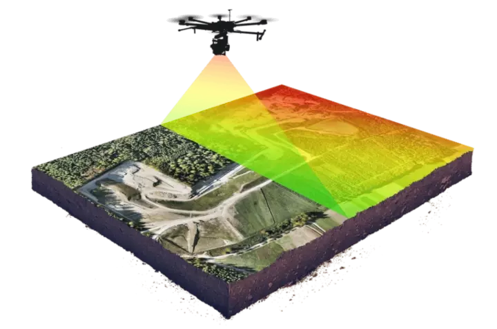
One of the key technologies we utilize is drone-based LiDAR mapping, which allows us to capture highly detailed elevation and terrain data from the air. Using FAA Part 107 certified drone operations, our aerial platforms can safely and efficiently map large areas, complex terrain, and wooded environments that would otherwise require significant time and resources using traditional ground surveying methods alone.
Drone LiDAR technology produces dense point cloud data and digital elevation models, providing engineers and project planners with highly accurate site information for design, analysis, and planning. This data can be used for topographic surveys, infrastructure planning, land development projects, construction monitoring, and environmental analysis.
In addition to aerial mapping systems, Ascension Surveying utilizes modern GNSS positioning equipment, high-precision surveying instruments, and advanced data processing software to ensure reliable and consistent results on every project.
By investing in modern technology and maintaining a strong foundation in traditional surveying practices, Ascension Surveying is able to deliver accurate geospatial data, efficient project timelines, and dependable surveying solutions for clients throughout North Carolina and Tennessee.

Projects We Support
Ascension Surveying provides professional land surveying, drone LiDAR mapping, and aerial terrain modeling services that support a wide variety of engineering, construction, and development projects throughout North Carolina and Tennessee. Our team works closely with civil engineers, developers, contractors, and infrastructure professionals to deliver accurate geospatial data that helps projects move forward efficiently and with confidence.
By combining traditional surveying expertise with modern drone-based LiDAR technology, we are able to collect highly detailed terrain and site data across large areas, complex environments, and active construction sites. This information supports planning, engineering design, land development, and infrastructure projects by providing reliable measurements and accurate elevation data.
Ascension Surveying regularly supports projects including land development planning, construction site mapping, infrastructure corridor surveys, large acreage terrain mapping, and environmental or forestry mapping. Our goal is to provide the precise data professionals need to design, build, and manage projects successfully.
Whether supporting early planning phases or ongoing construction operations, Ascension Surveying delivers dependable surveying and mapping solutions that meet the needs of modern engineering and development projects.

Industries We Serve
Surveying Solutions for Engineering, Construction, and Development Projects
Ascension Surveying provides professional land surveying, drone LiDAR mapping, and aerial terrain modeling services for a wide range of industries throughout North Carolina and Tennessee. Our team works closely with engineers, developers, contractors, and infrastructure professionals to deliver accurate geospatial data that supports planning, design, and construction.
By combining traditional surveying expertise with modern drone-based LiDAR technology, we are able to efficiently collect highly detailed terrain and site data across large areas, complex environments, and active job sites. This information helps project teams make informed decisions and move projects forward with confidence.
Below are some of the industries we regularly support.
Civil Engineering
Ascension Surveying works with civil engineering firms to provide accurate topographic surveys, terrain models, and LiDAR mapping data used for infrastructure design, site planning, and engineering analysis. Our surveying data helps engineers develop reliable designs and accurate construction plans.
Construction
Accurate site measurements and reliable terrain data are critical to successful construction projects. Our construction surveying and drone mapping services provide contractors and project managers with precise site data for planning, construction layout, and progress monitoring.
Land Development
For residential and commercial development projects, detailed surveying information is essential during the planning and design stages. Ascension Surveying provides boundary surveys, terrain mapping, and development site surveys that help developers and planners evaluate property conditions and design efficient site layouts.
Utilities & Infrastructure
Large infrastructure and utility projects often require surveying services across long corridors or challenging terrain. Our drone LiDAR mapping and aerial surveying services help infrastructure planners efficiently collect accurate terrain data for utility corridors, roadway planning, and large-scale development projects.

Request a Surveying Consultation
If you are planning a project and need reliable land surveying, drone LiDAR mapping, or aerial terrain data, the team at Ascension Surveying is ready to assist. We work with civil engineers, developers, contractors, and infrastructure professionals throughout North Carolina and Tennessee to provide accurate geospatial information that supports planning, design, and construction.
By combining traditional surveying experience with advanced drone-based LiDAR technology, we are able to efficiently collect precise terrain data across a wide range of environments. Whether your project requires boundary surveys, construction site mapping, or large-scale aerial LiDAR data collection, our team is committed to delivering dependable results and professional service.
Tell Us About Your Project
Submit your project details using the form below and upload any relevant documents such as site plans, plats, CAD drawings, or engineering files. Providing this information allows our team to review the scope of your project and respond with the most accurate guidance.
Because much of our work takes place in the field on active job sites and remote locations, there may be times when we are temporarily unreachable due to limited cell phone service. If you do not receive an immediate response, please know that we will follow up as soon as we return to an area with reliable signal.